

After viewing Pigeon Island from the sea, by both boat and kayak, and by land from our marina, last week we decided to take a hike over there to check it out.
Ronan and Ryan, Fort Rodney, St. Lucia

Theresa, Fort Rodney, St. Lucia
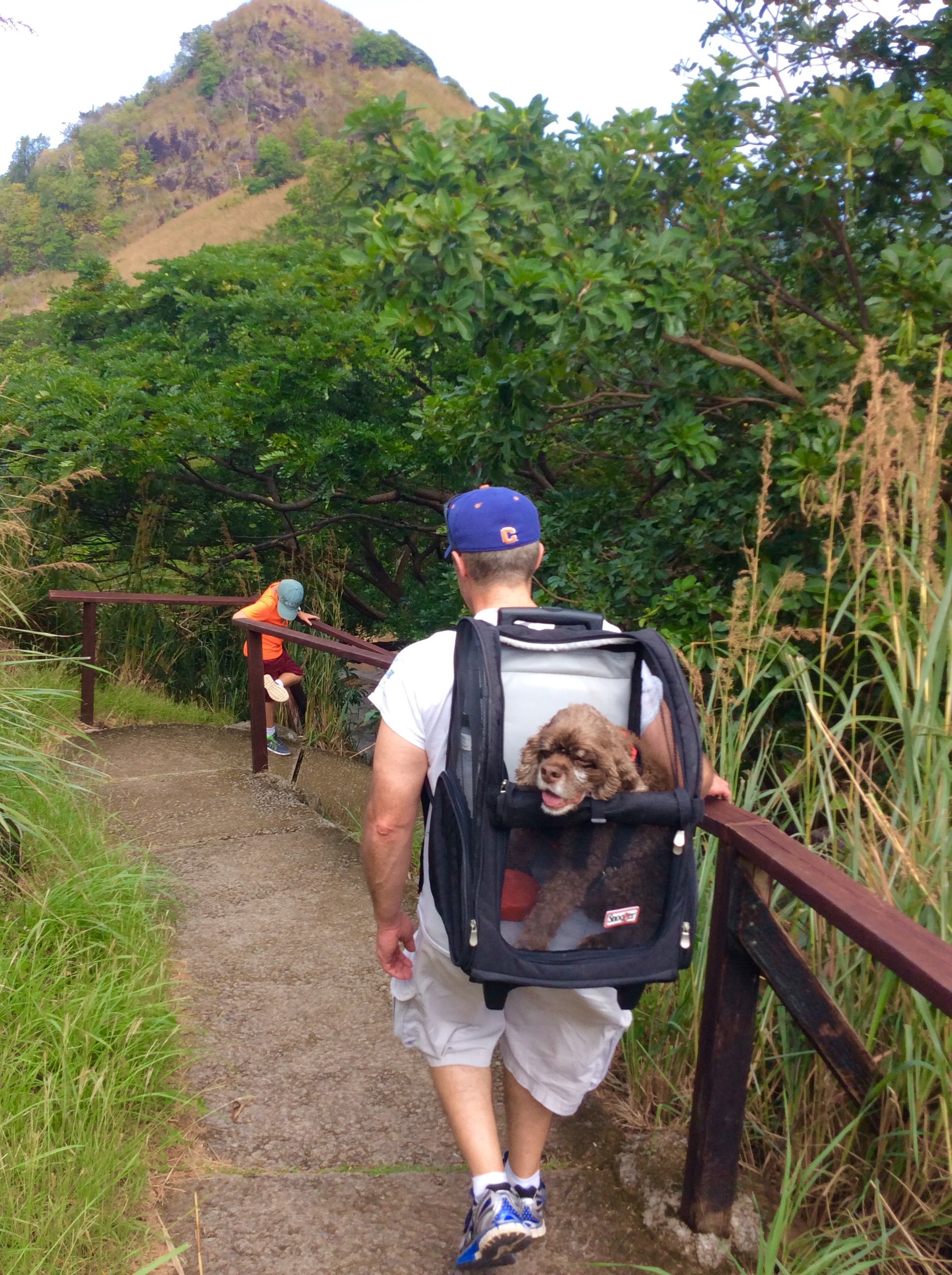
Taking a left out of the marina gate, it is approximately a 40-minute hike to the island. We had so much fun over there that when our Uncle Jim came to visit, we took him to the fort to explore too.
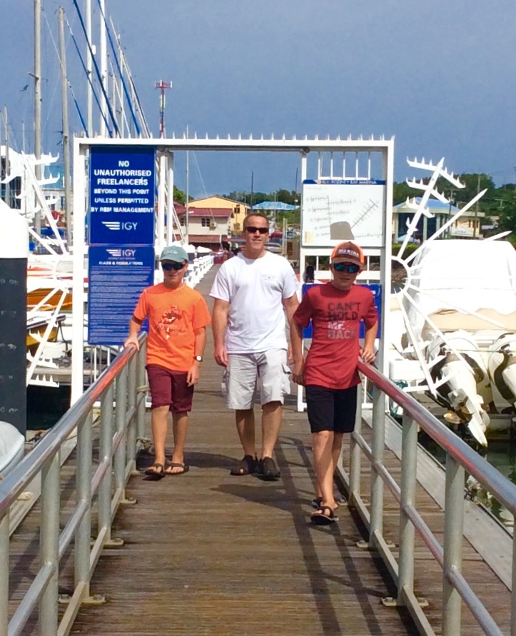
Ronan, Uncle Jim, and Ryan departing Rodney Bay Marina, St. Lucia
Pigeon island is actually connected to mainland St. Lucia (i.e. it’s more like a peninsula). Wondering why they call it an island, I looked it up and learned that “once isolated from mainland, St. Lucia, in the Caribbean Sea, the island was artificially joined to the western coast of the mainland in 1972 by a man-made causeway built from dirt excavated to form the Rodney Bay Marina. “Pigeon Island (Saint Lucia).” Wikipedia. Wikimedia Foundation, n.d. Web. 07 Jan. 2017.
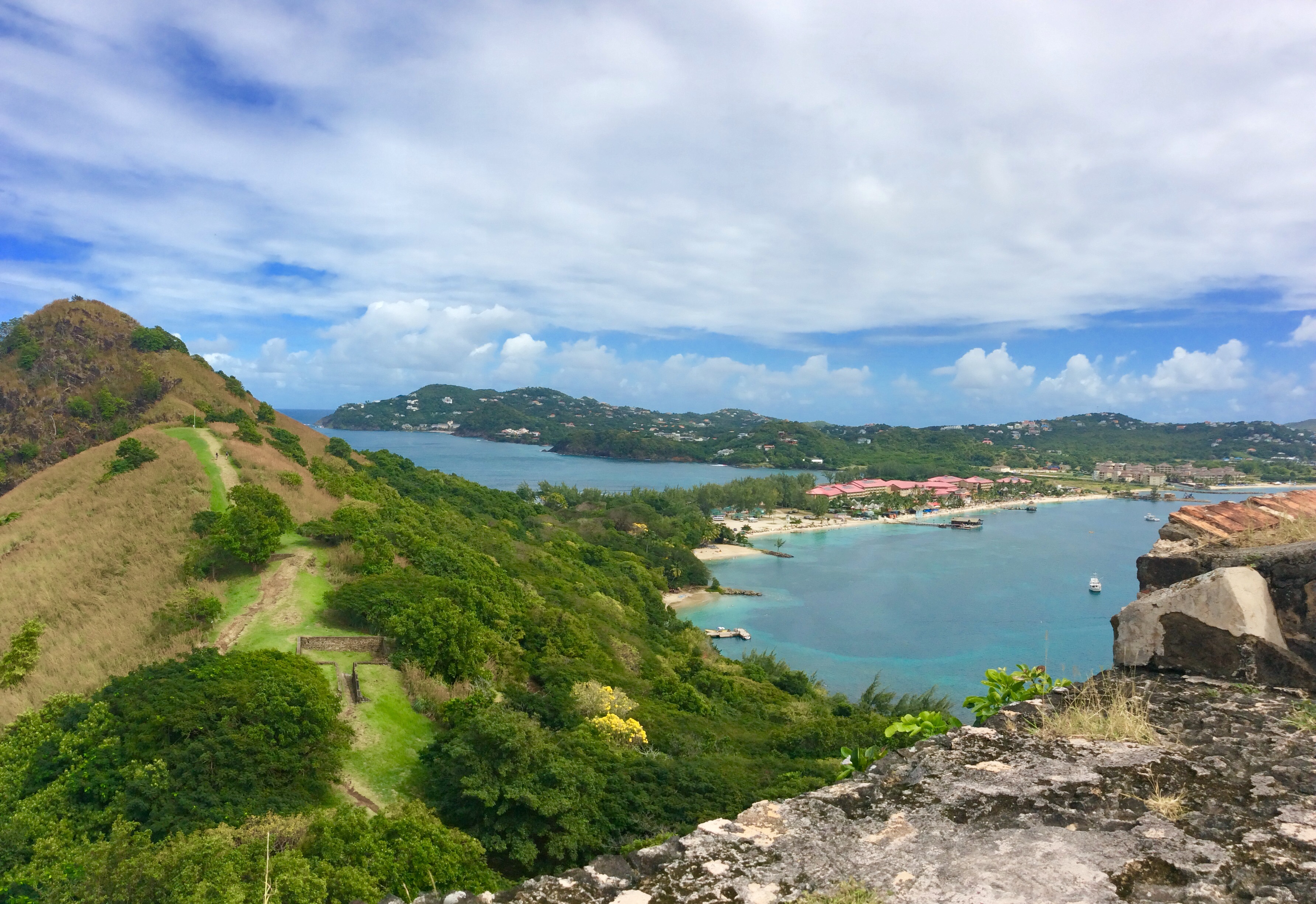
Pigeon Island land bridge (red roof tops are Sandals Resort), St. Lucia
After arriving at the Pigeon Island National Park, we paid the admission fee and started up the first hill to Fort Rodney.
Patton and Uncle Jim, hiking to Fort Rodney, St. Lucia


Fort Rodney is named after a renowned British Admiral. Admiral Rodney is most famous for defeating the French at the Battle of the Saintes in 1782. The French originally settled St. Lucia but they fought the British for it three years after signing their peace treaty with the Caribs in 1660. Control of the island switched back and forth 14 times, seven times to the French and seven times to the British. The British won control the fourteenth time and they had control of the island until St. Lucia gained their independence on February 22, 1979.
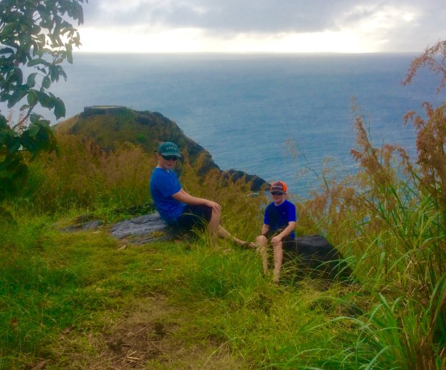
We first arrived at a platform overlooking Rodney Bay (also named after the Admiral). The views were spectacular!

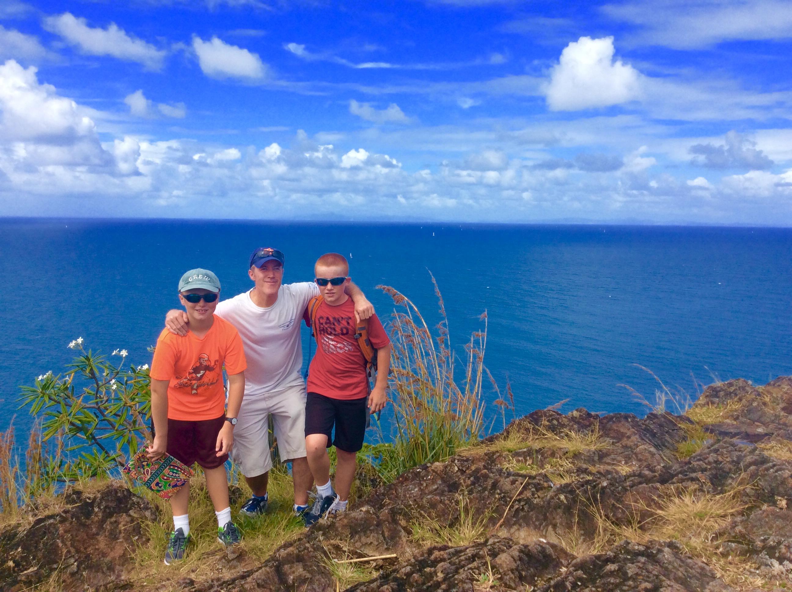
Theresa, Ryan, Ronan, Uncle Jim, and Patton, Fort Rodney, St. Lucia
On a clear day looking north you can see the island of Martinique, approximately nineteen (19) nautical miles across the Martinique/St. Lucia channel.
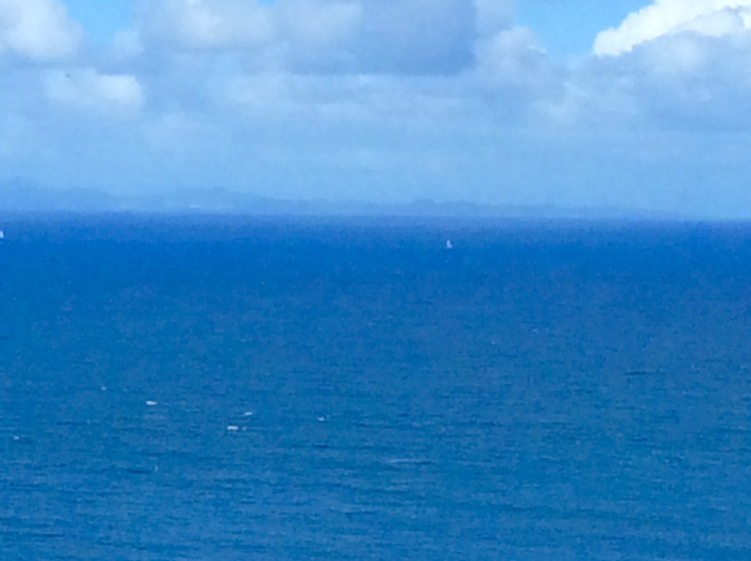
Looking north from Fort Rodney, Pigeon Island, St. Lucia (Martinique on the horizon)
When it was initially built in 1778, one of Fort Rodney’s purposes was to spy on French ships up in Martinique. The lower fort had a couple cannons and more great views. We even got to climb down a ladder into the gun powder room.


There was a sign explaining the system they used to bring cannons off of Admiral Rodney’s ships up to the fort. Using a pulley system, they hoisted the cannons off the deck to the top of the mast and then over to the fort.


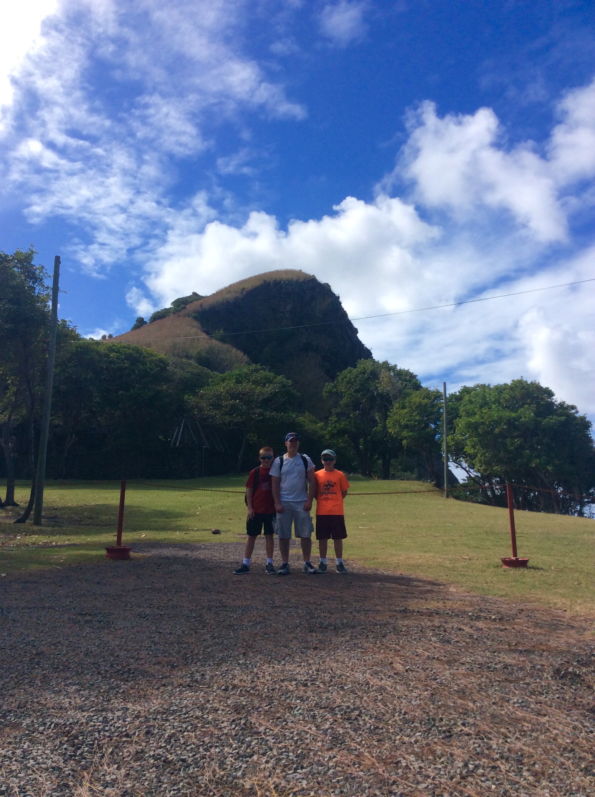
Patton and Uncle Jim, hiking Fort Rodney, St. Lucia
We went back down half way and then scaled the next hill. The trail up to Signal Peak was a little steeper than up to Fort Rodney. The signaling peak was used by the United States during WWII as a naval communications signal station until 1947. Flags were hoisted up a large pole to send signals to vessels at sea.
The views at the signaling station were just as good if not better than the views from the lower fort.

U.S. Signal Station (1941-1947), Fort Rodney, St. Lucia
Ronan, James and Ryan (Martinique on the horizon), Fort Rodney, St. Lucia
")


The hike down from the upper peak would be difficult for people afraid of heights. On our way down we saw a strategic fort on the side of the hill for armed soldiers to fire down on the enemy while being protected by the stone wall.


Ryan, Uncle Jim and Ronan, Pigeon Island, St. Lucia
We really enjoyed hiking around Fort Rodney, Pigeon Island with our Uncle Jim. I would definitely recommend this hike to anyone on St. Lucia. If you are staying at a nearby marina or anchorage, and you do not like hiking, there is a dinghy dock right on Pigeon Island.
VIDEO
Click image below for additional pictures and video of Fort Rodney, Pigeon Island, St. Lucia hiking adventure.

Great stuff. The boys. Will never forget this wonderful experience.
LikeLike
Super field trip with your Uncle Jim, Patton, and your mom! Your information about Fort Rodney is so interesting. Keep on exploring!
Love,
Aunt Patti
LikeLiked by 1 person